A British railway station can be many things. A place of tended flowers and toytown paintwork. A concourse of shuttered ticket booths and overpriced pasties. A terminus, a meeting spot, a gateway to escape. It can be heart-lifting or drab, bathed in birdsong or heaving with commuters. It can also be the starting point for a properly good walk.
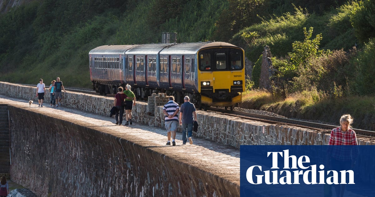
National Rail serves 2,593 stations, their locations scattered across the map like cartographic confetti. Many of them sit directly on longstanding hiking trails or within a short distance of paths worth exploring. In a large number of cases, it’s possible to walk between two stations following rights of way, rendering a car or taxi redundant.
Such routes are frequently scenic but often little-known, giving value to the prospect of a dedicated database of station-to-station walks. Might a disembarkation at Ffairfach, Whatstandwell or Crianlarich be the passport to your next hike? Quite possibly – which is where the recently launched Railwalks.co.uk comes in. Its aim is to create a crowd-sourced national network of rail-based walking routes, mostly ranging from two to 20 miles.
“If you’d asked me 20 years ago how much of Britain you could walk through while using public transport, I would have imagined, like everyone else, not very much,” says founder Steve Melia, an academic, author and one-time Lib Dem parliamentary candidate who gave up flying in 2005 and driving in 2009. “I discovered that that’s not true. You can walk virtually everywhere in England by train – and bus, but mainly trains – and a lot of Wales and Scotland.”
I meet Steve near the station in the Wiltshire town of Bradford-on-Avon, from where we’re taking a nine-mile countryside walk to Bath Spa station. It’s one of the first truly fine days of spring, a breezeless morning of sunshine and plum blossom. Twenty four hours earlier we’d have got drenched, but today the skies are blue, the blackbirds are fluting and the dandelions are blinding. We head to the banks of the Kennet & Avon canal, bear west and begin.
Steve first had the idea for the website, which was unveiled in January in partnership with like-minded walking organisation Slow Ways, when he moved to Bristol in 2009 to teach transport and planning at the University of the West of England. “I started doing public transport-based walks each weekend,” he says, as the canal path leads us past narrowboats and banks of forget-me-nots. Waggy-tailed terriers zigzag the other way. “I like to walk somewhere different every time I go out, and the fact I was able to do that for 15 years and still find new routes made me think there was more to this than people realise.”
Soon we reach a path across open fields. A herd of friesian cows graze in the middle distance. The route we’re following is one of many that Steve has plotted (he’s a fan of poring over paper maps) then uploaded online as a GPX file (which can be found here). He’s one of four volunteers managing Railwalks, an umbrella website that has gathered together relevant regional webpages listing local rail-based hikes. These include a wide variety of sources (with a varying level of detail) from walking and community groups to local authorities and individuals such as Steve. His collection of walks near Bristol (greentravelwriter.co.uk/rail) sit alongside other day-walk itineraries everywhere from the South Downs to the Scottish Highlands.
This, however, is just the beginning. By partnering with Slow Ways – which is midway through creating a web of walking routes that connect all Britain’s towns, cities and national parks – Railwalks aims to eventually offer a comprehensive, searchable, national network of rail walks, a mixture of station-to-station routes and circular hikes. And like Slow Ways itself, it needs your help.
“We’re asking people to add new walks,” says Steve. This involves signing up to Slow Ways via the Railwalks website or, for those already registered with Slow Ways, adjusting their profile settings to incorporate Railwalks (instructions for both options can be found at railwalks.co.uk/how-to-help). “The idea is that our network will eventually go into a separate section of the Slow Ways site,” says Steve.
The concept at its core is admirable. Few pleasures are more simple than cross-country rambling with a trail at your feet and hours at your disposal. Our route to Bath winds up and down across the hills. We pass through pretty limestone villages with old-world names – Avoncliff, Limpley Stoke, Monkton Combe – and stop at the 16th-century Inn at Freshford for liquid sustenance. On the trail, wrens trill and the scent of wild garlic hangs on the woodland verges.
after newsletter promotion
Steve acknowledges that relying solely on trains can pose problems for hikers – not least the cost – but he and his fellow volunteers are passionate about spreading the word that rail-based walks aren’t only feasible but can also be deeply enjoyable.
Now in his early 60s, Steve goes walking at every opportunity. As we descend towards Bath down a long green meadow, the city’s Georgian crescents glinting in the afternoon sun, I notice his boots. They look as if they’re carrying the dust of a decade-long pilgrimage and I mention the fact. “What, these?” he laughs. “I only got them a few months ago.”
Three of Steve Melia’s favourite station-to-station walks
Torquay to Teignmouth, Devon
Distance: about 12 miles.
Tracing a section of the South West Coast Path along a scenic stretch of the Devon coastline.
Cynghordy to Llandovery, Carmarthenshire
Distance: about 7 miles.
An undulating route between two stations on the Heart of Wales line, finishing in the market town of Llandovery.
Bempton to Filey, Yorkshire coast
Distance: about 10 miles.
A clifftop walk along the North Yorkshire Coast, with the chance to spot breeding seabirds on Bempton Cliffs in spring.