Nestled among the San Gabriel Mountains is a stretch of picturesque highway that comes to an abrupt end near a scenic overlook. California closed the road, once a vital link between mountain communities outside of Los Angeles, way back in 1978 due to an emergency. The highway has never reopened.
Highway 39 beats a broken path through some of the most beautiful scenes in Los Angeles County. Starting near the ocean in Huntington Beach, it breaks 22 miles north, picking back up again in Azusa, California, before winding north up through the San Gabriel Mountains.
Highway 39 once connected to State Route 2 at a mountain pass known as Islip Saddle. The route cut the drive through the mountains by over two hours, according to Highway 39 explorer, Sidetrack Adventures. The highway wasn’t open long before a massive rockslide shut it down. There have been attempts to repair Highway 39 over the years, but the costs have only gone up in the 45 years since the rock slide, with more debris and even water now flowing over the road.
Before its closure, Highway 39 was considered one of the most scenic drives in California. It’s such a beautiful stretch, running through Angeles National Forest, that the final scene of Fast & Furious: Toyko Drift was shot using portions of Highway 39. As you can see from the video posted by AdventureEveryDay just a few days ago, the views and driving roads are spectacular:
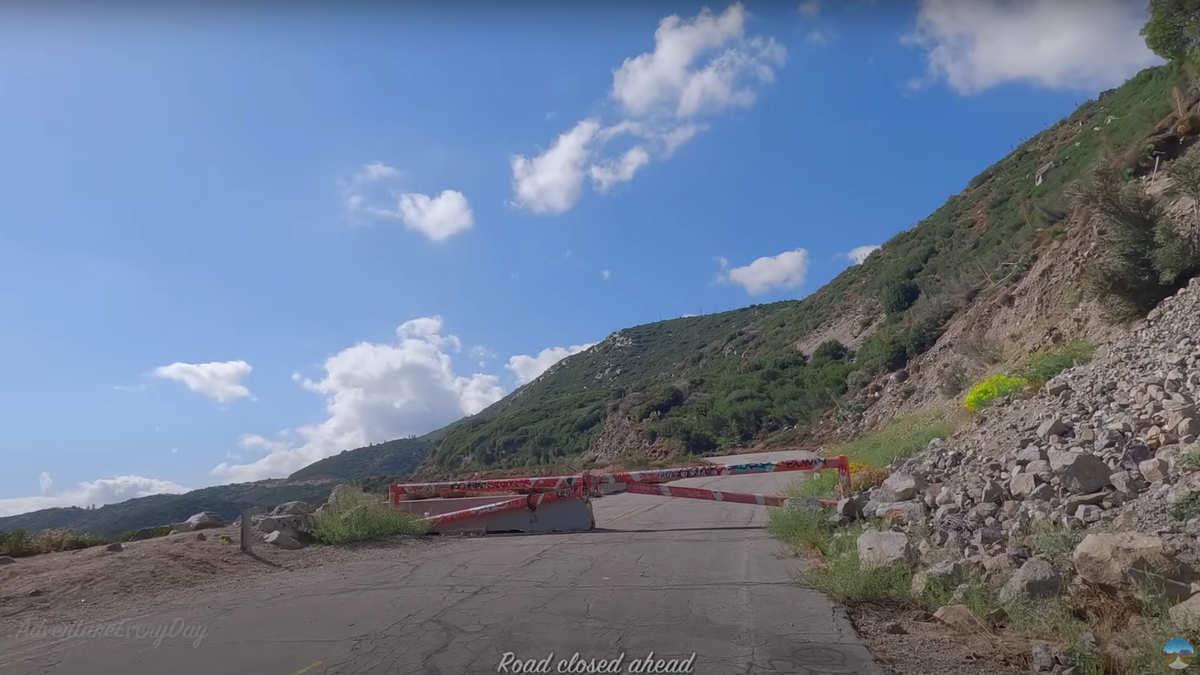
It’s around the 49:00 minute mark when the drive ends at a heavily graffitied orange gate. This spot is marked as the San Gabriel Canyon Lookout on Google Maps. The only motor vehicles allowed beyond this gate are emergency vehicles, which the YouTuber encountered while exploring the stretch of highway beyond the barrier. On what may be one of the most beautiful stretches of road in California, hikers and bike riders rule.
Even just a few feet into exploring the abandoned highway it’s clear as day why the road remains closed: rock falls and landslides make this stretch hazardous. Google satellite view shows just how treacherous Highway 39 has become.
Yeah, I’d skip that, though SidetrackAdvetures found evidence that some work is being done to keep the route safe, like some recently installed guardrails, these are likely for the various emergencies vehicles that still use the route, such as CAL Fire.