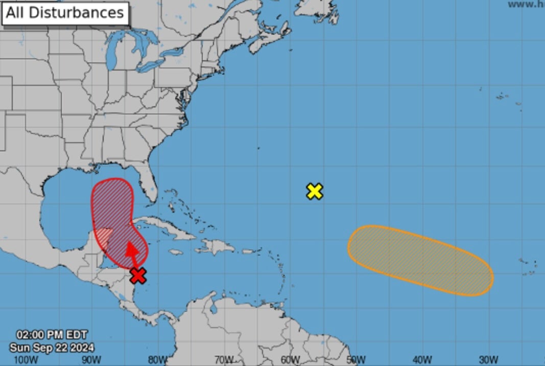
Storms are brewing in the Atlantic and two areas have forecasters warning the US Southeast about their potential impact.
There are three systems currently out in the Atlantic, and two have a 50 percent chance or greater to become formed storms in the next seven days, according to the National Oceanic and Atmospheric Administration.
A third storm is in the Atlantic, but it is not expected to form into a named storm over the next weeks.
The first area of concern is off the coast of Central America. That system has an 80 percent chance of becoming a formed storm in the next week, according to forecasters. That system is expected to continue north and impact the Yucatan Peninsula of Mexico.
From there, its projected path shows it moving north into the Gulf of Mexico, then targeting the US, specifically Louisiana, Alabama, Mississippi and Florida. But its path could still change as the storm develops.

The storm is expected to bring heavy rains to parts of Central America over the next few days.
“Regardless of the exact track, tropical impacts are expected along parts of the Gulf coast later this week or next weekend,” AccuWeather meteorologist Grady Gilman said.
He also warned that the warm Gulf temperatures, which are currently in the mid-80s, will add fuel to the storm.
“It is typical for tropical features to rapidly intensify over this area at this time of the year to begin with, but now we’re looking at well above historical average temperatures possibly contributing to a significant intensification of a tropical system,” he said.
The other system is closer to Africa in the Atlantic but has a 50 percent chance of becoming a named storm over the next week. That storm’s projected path is hard to know for sure. Current projections show it moving toward the Caribbean. From there, it could target America.
The next name for a formed storm will be Helene.

